
Accessible Tallinn
Client
Tallinn Strategic Management Office
Tags
SD
Year
2024
Tallinn is a leader in digital innovation, yet mobility remains a challenge for many. Navigating the city can be frustrating—especially for people with disabilities, parents with strollers, and the elderly—due to fragmented accessibility data and unreliable real-time updates. This project introduces a unified digital twin-powered system that brings together public transit, real-time conditions, and accessibility data into one seamless tool. By prioritizing first-person navigation, it ensures that everyone can move freely, independently, and efficiently across the city.
Highlights
Conducted research on mobility challenges for people with disabilities in Tallinn, identifying major gaps in existing navigation systems.
Designed a digital twin-powered platform that unifies public transit, accessibility data, and real-time environmental updates into a single interface.
Created a first-person navigation prototype for individuals with mobility challenges, streamlining fragmented information sources.
Explored sensor-based data collection (e.g., snow-clearing status) to enhance real-time accessibility updates.
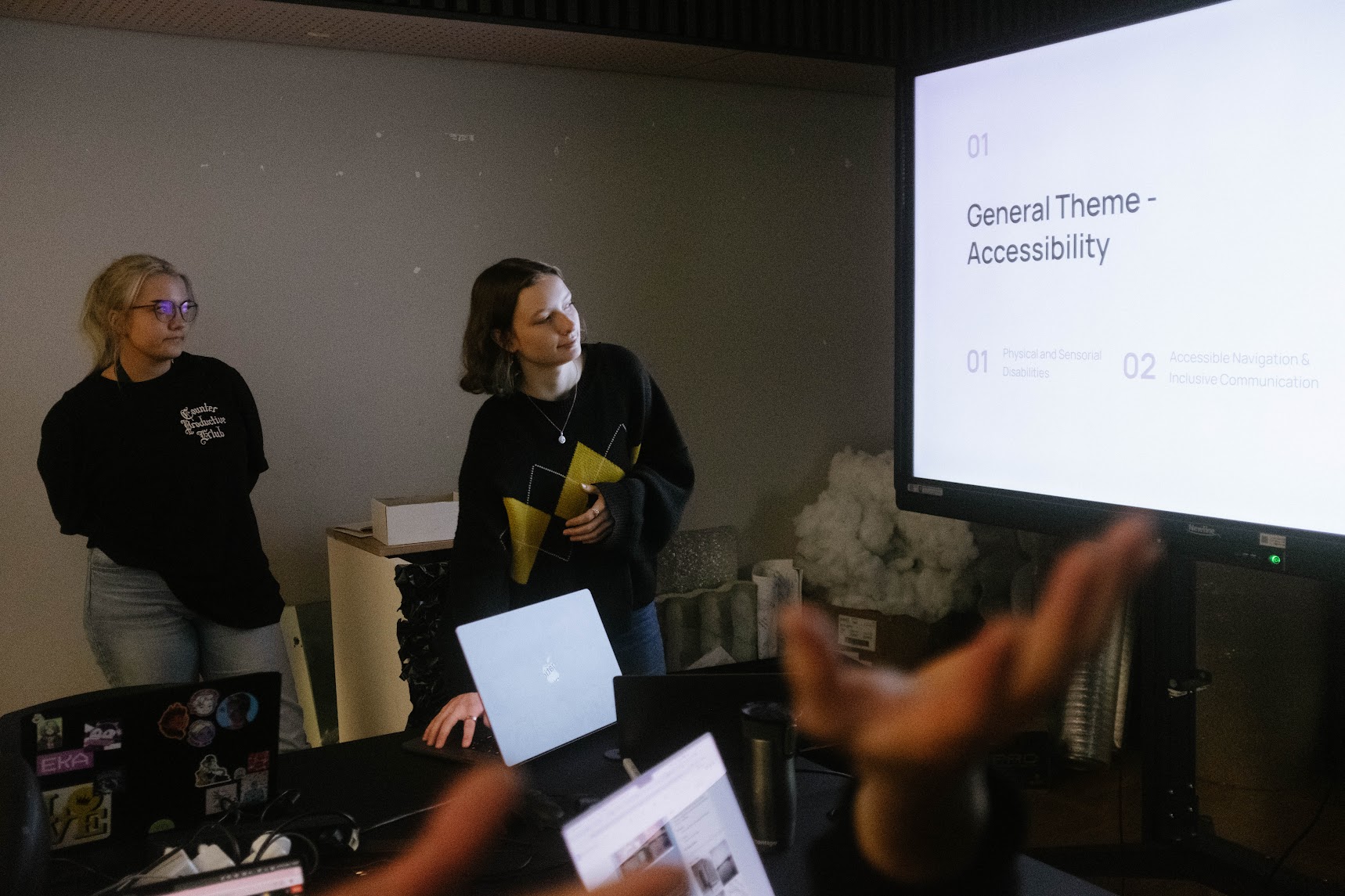
Developed a compelling pitch and presentation to investors, focusing on the economic and societal benefits of an inclusive mobility system.

Context
Tallinn is one of the most digitally advanced cities in the world, yet navigation remains a challenge for many—especially those with mobility impairments. Accessibility information is fragmented across different platforms, requiring users to check multiple sources to plan their routes. Snow-covered sidewalks, missing real-time updates, and inaccessible transit stations make daily commutes difficult. This project aimed to create a centralized, real-time mobility solution that enhances navigation for everyone.
The Problem
People with mobility impairments face significant challenges when navigating the city:
Fragmented Information: Accessibility details are scattered across different platforms (maps, transit schedules, weather apps, etc.), making trip planning frustrating.
Unreliable Route Conditions: Lack of real-time updates on obstacles such as snow, construction, or broken elevators in transit stations.
Limited Accessibility Features: Existing navigation apps primarily serve able-bodied users, often failing to provide personalized routes for those with specific mobility needs.
This results in limited independence, missed opportunities, and exclusion from daily activities for thousands of residents and visitors.
Solution
A digital twin-powered navigation system that consolidates real-time data sources into an intuitive, first-person navigation tool for people with mobility impairments.
Key Features:
First-Person Navigation Mode – Users receive step-by-step guidance based on their personal mobility needs.
Custom Route Suggestions – Routes are optimized for accessibility, avoiding barriers like stairs or steep inclines.
Real-Time Updates – Live data from sensors, transit systems, and user reports ensures up-to-date navigation.
Unmapped Routes – Integrates new data sources (e.g., snow-clearing sensors) to provide the most accessible paths.
By merging data from public transport, weather updates, and real-time accessibility reports, this solution empowers seamless, stress-free navigation.
Design Process
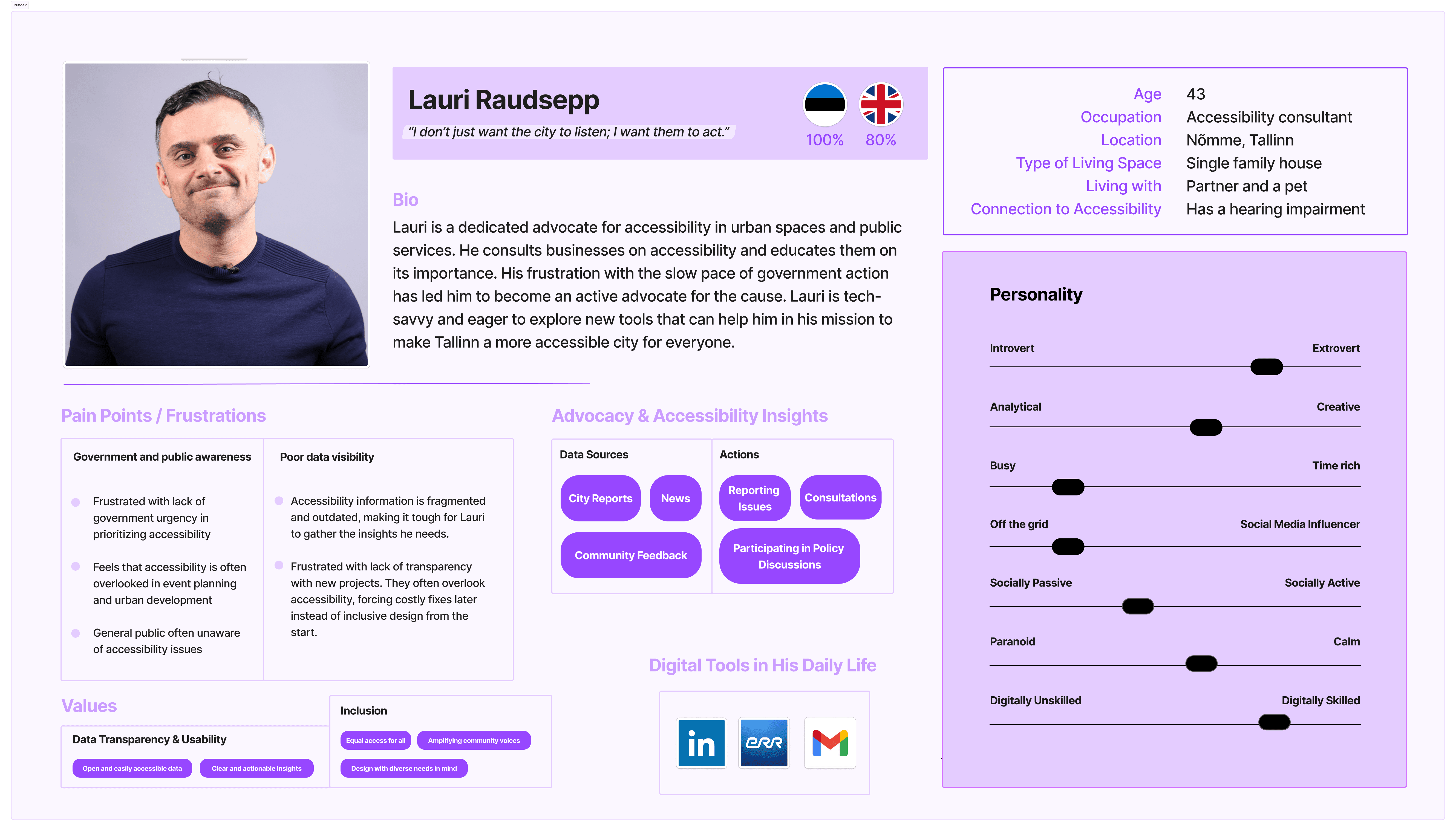
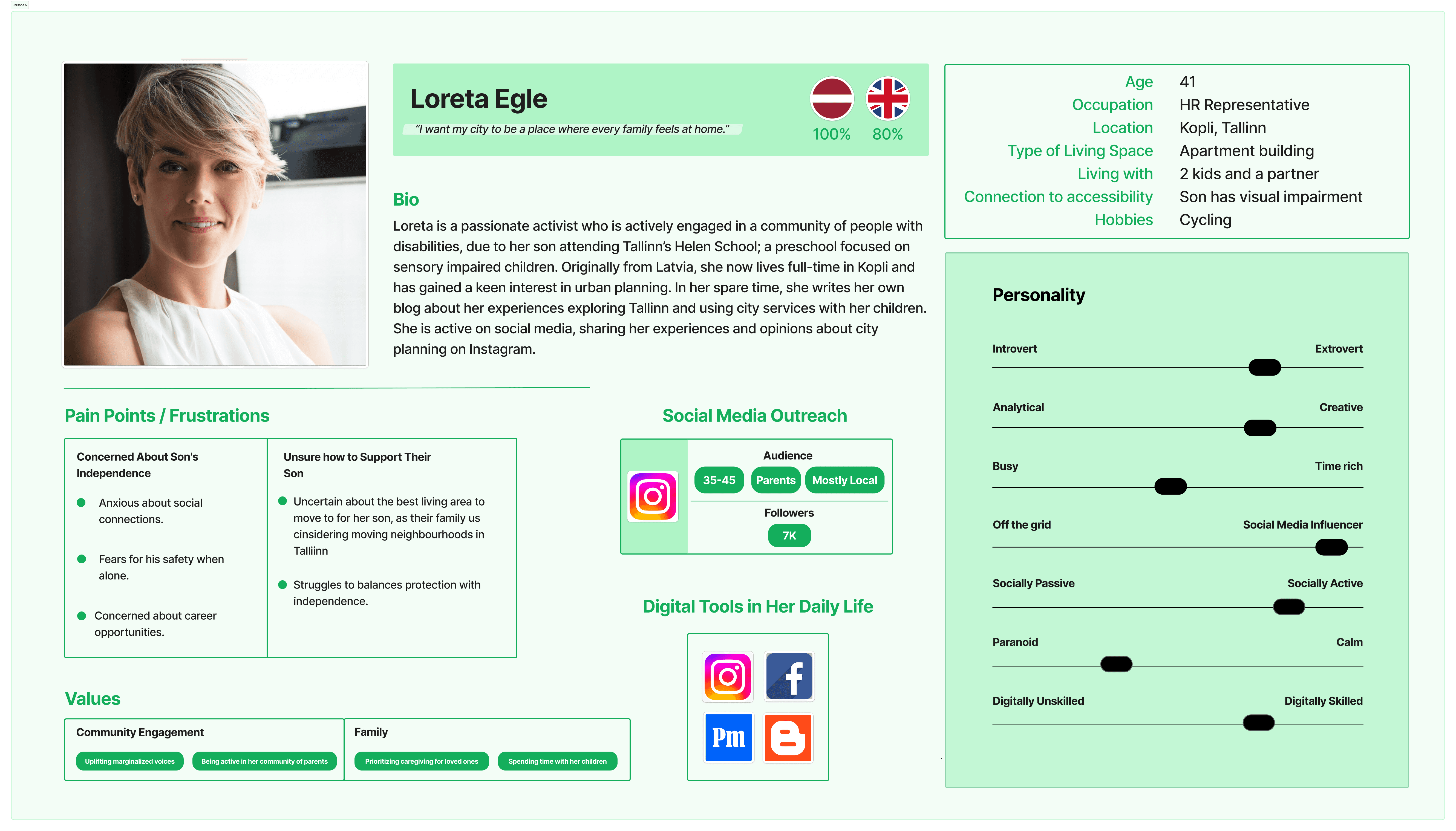
Conducted desk research and interviews with wheelchair users, elderly residents, NGOs, government bodies, and parents with strollers to understand their navigation struggles. Based on the gathered information we formed user personas to move forward.
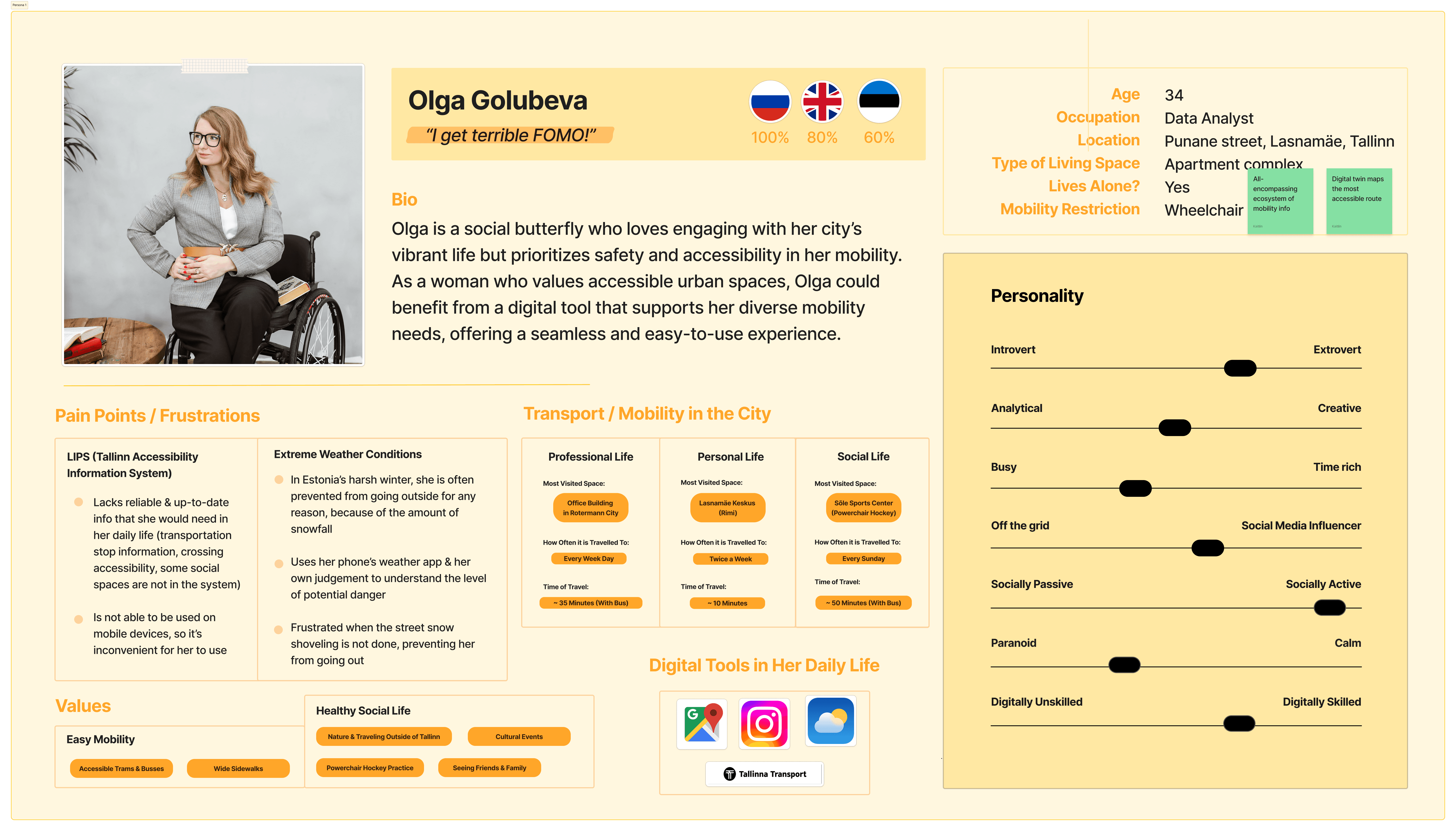
Based on our first persona - Olga - we mapped out the user journey.

In the ideation phase we explored various ways to aggregate and visualize citywide accessibility data using digital twin technology.
Afterwards we compared existing navigation apps to determine gaps in accessibility features.
We then designed a user-friendly Figma prototype that integrates multiple data streams into one interface.
And finally gathered feedback from people with disabilities and refined the interface based on usability concerns.
Value & Impact
This project doesn’t just benefit 8.4% of Estonia’s population who live with disabilities—it improves mobility for everyone. Parents with strollers, elderly citizens, and tourists navigating an unfamiliar city would all benefit from a more intuitive and accessible Tallinn.
For the government and transit authorities, this system offers:
Cost savings – Prevents unnecessary infrastructure investments by optimizing existing routes.
Improved public transit efficiency – Better data leads to smarter planning.
Overall a stronger economy – Increased accessibility allows more people to participate in work, education, and social life, thereby boosting the economy.
Retrospective
What Went Well:
Successfully identified a clear accessibility gap and designed an innovative solution around it.
Built a strong business case for government adoption, emphasizing economic and social benefits.
Future Improvements:
Expand testing with a larger user base to refine features.
Explore partnerships with transit authorities and private companies for real-world implementation.